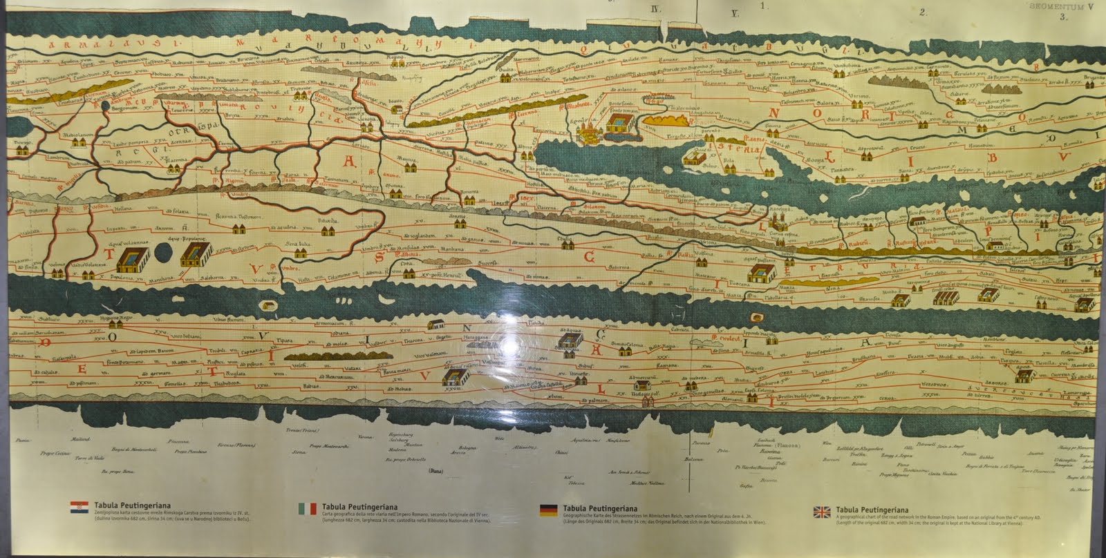
But the puzzler was this Roman view of cartography long before Western mapmakers pointed charts to the north and attempted to depict the shapes of landforms that astronauts would someday photograph from on high. It's a copy of the 20-foot-wide Tabula Peutingeriana, the most famous itinerarium (Roman road map). Just about anything you see will be a copy based in part upon a 25-year effort by 3 Greek geographers that was carved in stone and placed near Rome's Pantheon around 44 BCE. This version is a copy of a 13th-century parchment reproduction made by a monk and hardly ever displayed by the Viennese museum that now protects it. In this map, Rome is literally the center of its 5th century world. (North is left). The "wall" at center is the Apennines range that backbones Italy. At top is the Dalmatian coast with the Istrian Peninsula (and Pula) just to the right of center.Anyone thinking of Saul Steinberg's "View of the World Cover" for a 1976 New Yorker? Or maybe an old AAA TripTik.
First | Previous Picture | Next Picture | Last

