 |
Kauai's Na Pali Coast by Land, Sea, and AirVisited August 2005
|
|
Kauai's Na Pali Coast by Land, Sea, and AirVisited August 2005
|
 |
TIP: Double Click on any word to see its definition
TIP: Push F11 to see more of these pictures
|
|
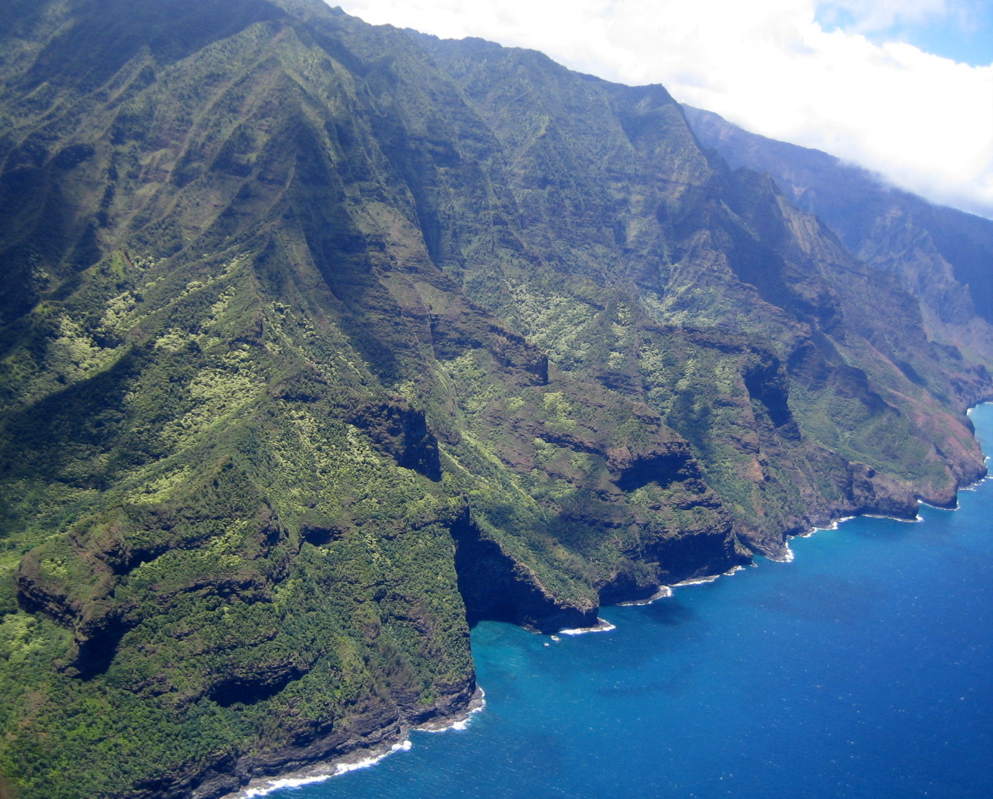
One of the most beautiful spots on the planet, the Na Pali Coast comprises about 15 miles from the 11 o'clock to 12 o'clock position on Kauai. Na Pali means "the cliffs" and this rugged and nearly inaccessible shore earned that name as the unrelenting Pacific and Hawaiian rains combined to carve 5 steep river valleys from the 6-million-year-old lava shield mountains. One day the ocean will win and Kauai will be a sunken atoll. We were lucky enough to see this coast on foot, by sail, and by helicopter. Next time we'll do it by kayak. Here's a photo from the helicopter showing the cliffs meeting the sea. The surf continually undermines the rock until ledges collapse into the brine. |
 |
|
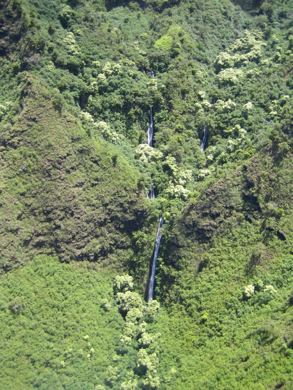
The older the Hawaiian island, the prettier, as time and water allow waterfalls to sculpt rugged valleys. None is prettier than the oldest, Kauai, where the relatively gentle magna created shield volcanoes (think of upside-down woks). High mountains stop the moist trade winds, forcing their air upwards where it cools and creates some of the wettest spots on earth. Rain-gorged waterfalls create channels that carve the soft volcanic rock into green-ribbed valleys: |
 |
 |
For a novelist's view of the trail, click here |
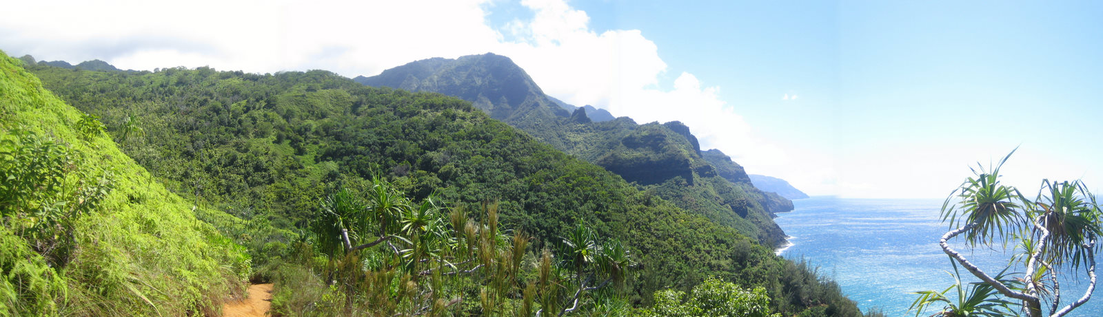
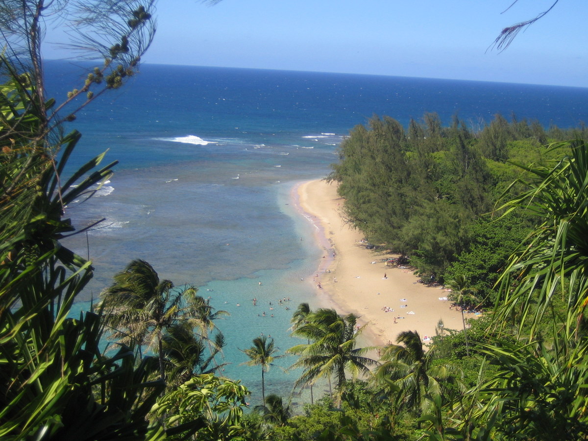
With good reason, the most famous hiking in all Hawaii is the Na Pali's Kalalau Trail. It starts where the road ends and its 11 miles climb and descend 5 river valleys of breath-sucking cliffs. A similar trail linked the native Hawaiian villages that have all disappeared (although a few people now live here outside of the law.) Good hikers can move about a mile per hour (with full backpack, of course.) Mountain goats are often visible but unlikely to help carry the load. The photo at the top of the page was taken from the first (eastern) part of the trail and shows a typical view. (You stop to rest a lot and so have time to look). The photo below shows a view of Hanakapi'ai Beach from high on the trail. This is one of the few beaches that the Pacific tolerates along this coast. |
 |
|
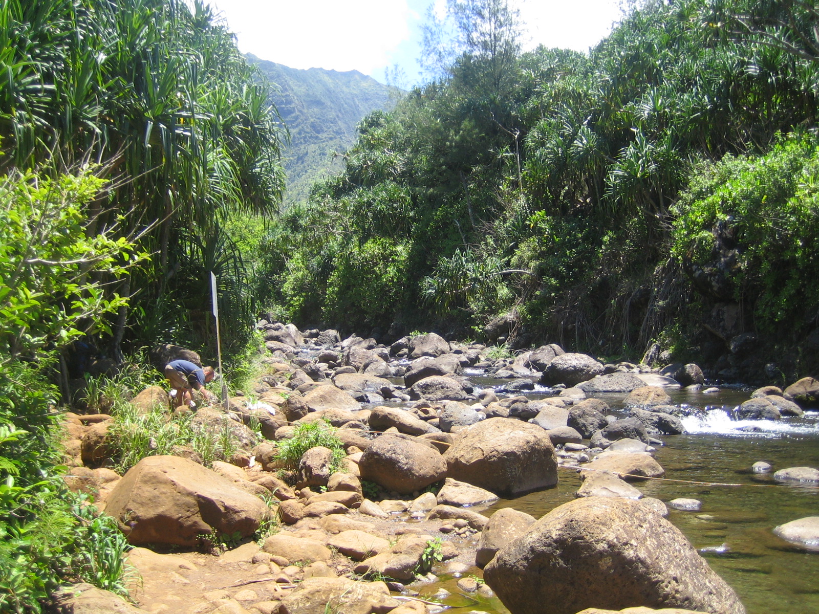
Without backpacking equipment or ambition, we decided to hike the easiest and most accessible part: from Ke'e Beach where we parked the car to Hanakapi'ai Beach. While this was only 2 miles in, the early August heat and our lack of water convinced us to turn around after playing on the beach for an hour or so. Here's where the river crosses the trail, just south of Hanakapi'ai Beach. Note the rope used to assist crossing during moderate currents. (Warning signs tell you not to cross when the current is swift. People drown here all the time.) |
 |
Two by Sea |
Had we enough water, we would have ventured south another 2 miles into the Hanakapi'ai Valley where guidebooks (and returning hikers) told us about a spectacular waterfall. Beyond Hanakapi'ai beach, the state park requires camping permits as the fair assumption is that you can't make it in and out on the same day. The hike there is world class --and tough. The Sierra Club categorizes this as a class 9 (10 max) hike. |
 |
Reminder: double click on any word you'd like explained further. |
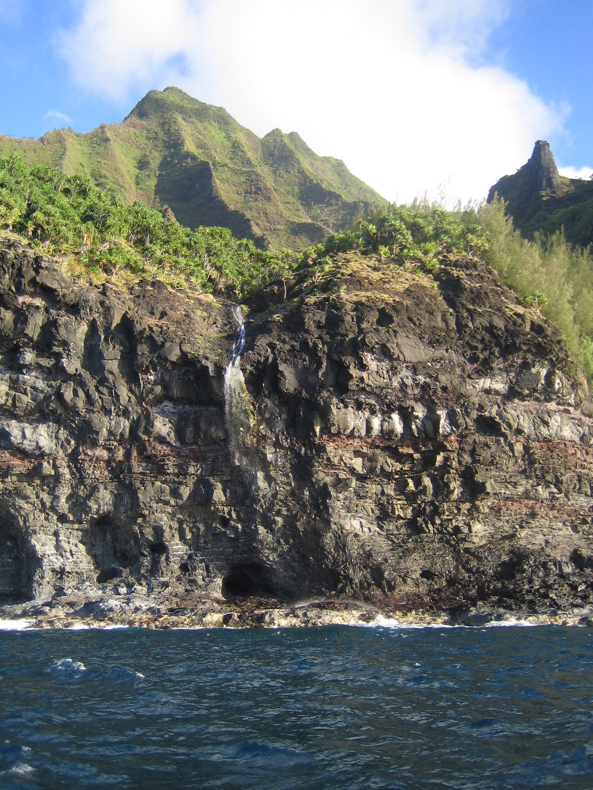
We spent a sunny afternoon sailing along the Na Pali coast, seeing from afar the hike we didn't finish. From this vantage point, it's obvious that the Pacific is winning the battle against the volcano as seen in the picture above. Kauai's high rains creates powerful waterfalls that carve the soft volcanic rock into 4000' ridges soon blanketed by the lush green of Hawaiian sun and rain. In the meantime, the ocean (sometimes here with 40' waves) crashes relentlessly against the rocks, carving them out underneath, until the suspended rock above crashes into the sea, forming ever steeper cliffs. Eventually the island will be worn into a crater like Molokini. (To see the rest of our photos from the sail, click here). |
 |
|
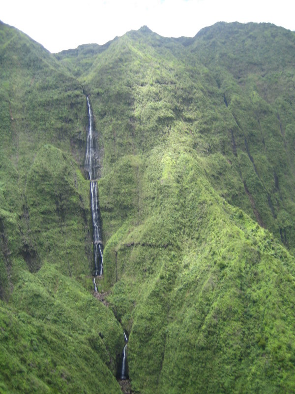
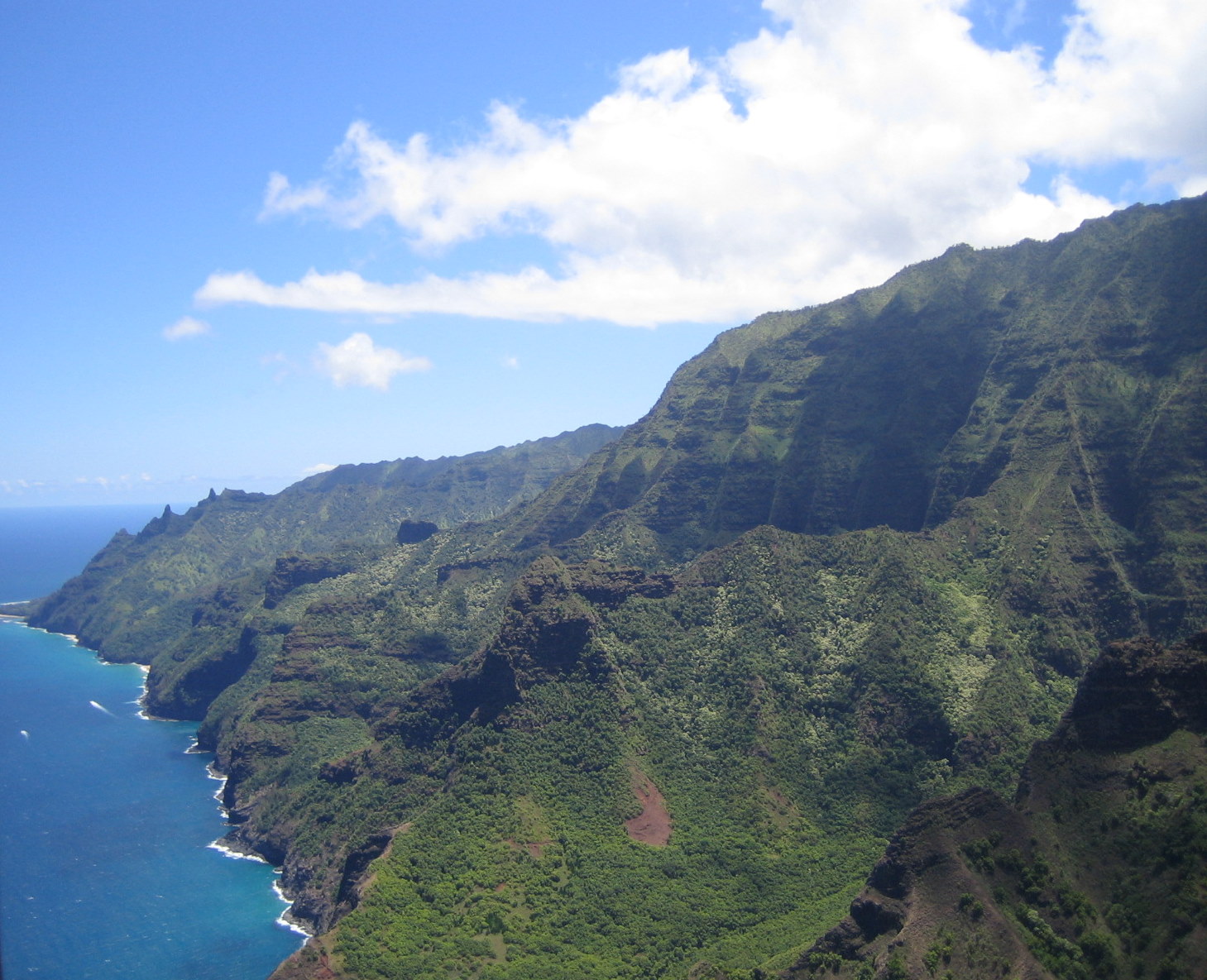
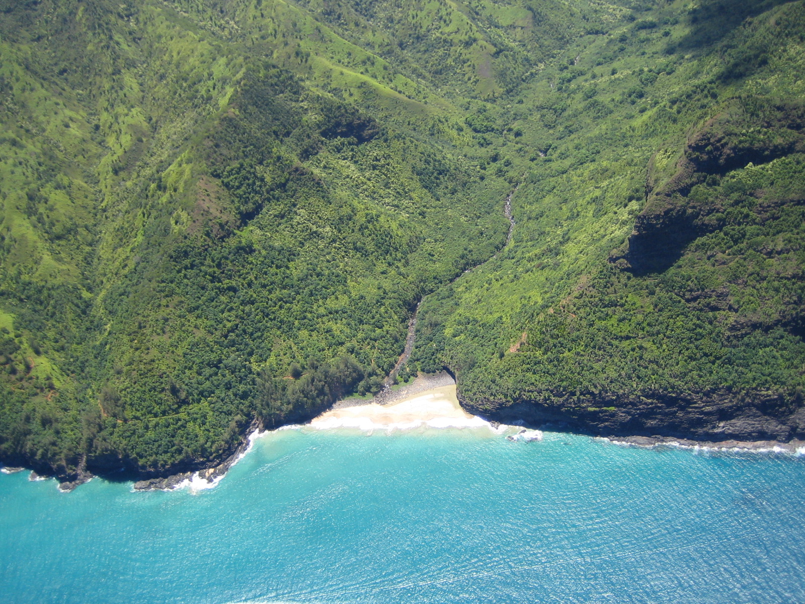
For another view of the Na Pali Coast, take to the air as we did for a spectacular hour near the end of our Kauai'an visit. Above you can see one of the several valleys which contained Hawaiian settlements linked by paths near the sea. Most of their travel was by canoes, and not too often in the rough winter seas. The isolation of this coast itself offered protection to the inhabitants who exploited the bountiful fresh water from the waterfalls and streams and used it to irrigate their taro patches. Below is another picture taken directly above one of these valleys. Today modern Hawaiians are beginning to explore the archeological sites of their predecessors. |
 |
|
In case you missed a link to our pages of supplemental pictures:
|
![]()
This
work is licensed under a Creative
Commons Attribution-NonCommercial-NoDerivs 2.5 License.