History and Harbor

Málaga, Spain

Visited September 20 and October 3, 2008

Everyone’s heard of Seville, but what of Andalusia’s second biggest town, Málaga and its half million Malagueños? This gateway to Spain’s Costa del Sol has a little of everything that’s good about Andalusia including Mediterranean beaches, rugged mountains, Phoenician/Greek/Roman/Moorish history, massive Holy Week processions and floats, beautiful strip parks, and a huge cathedral.

Malaga panorama

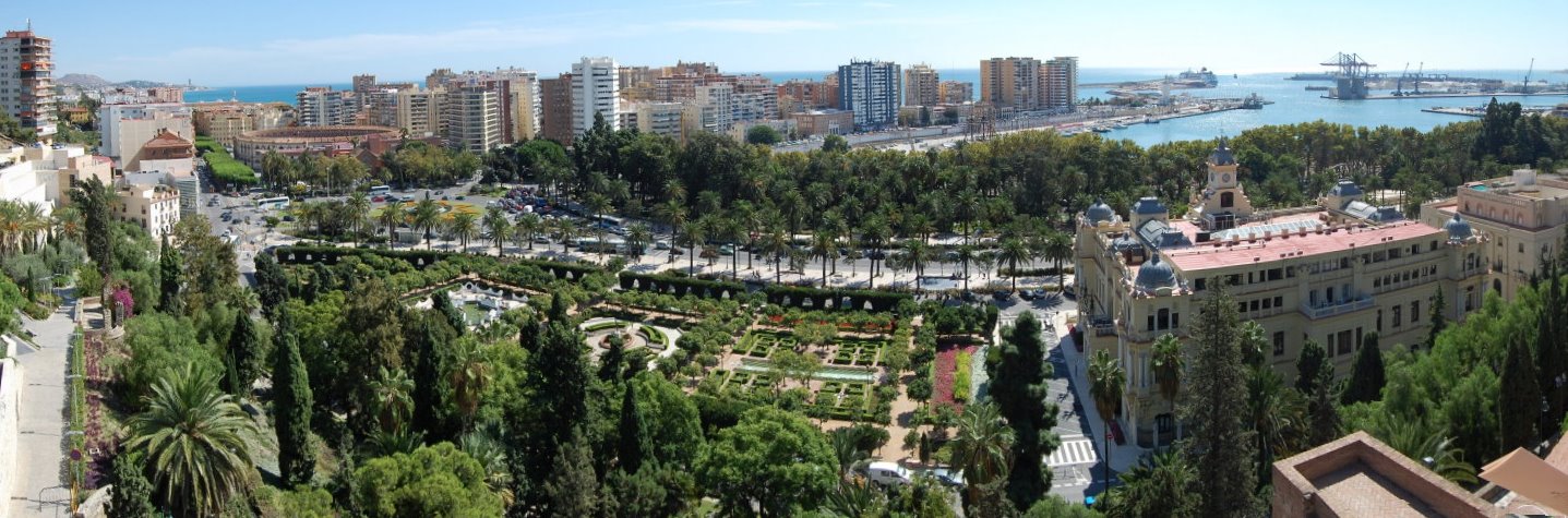
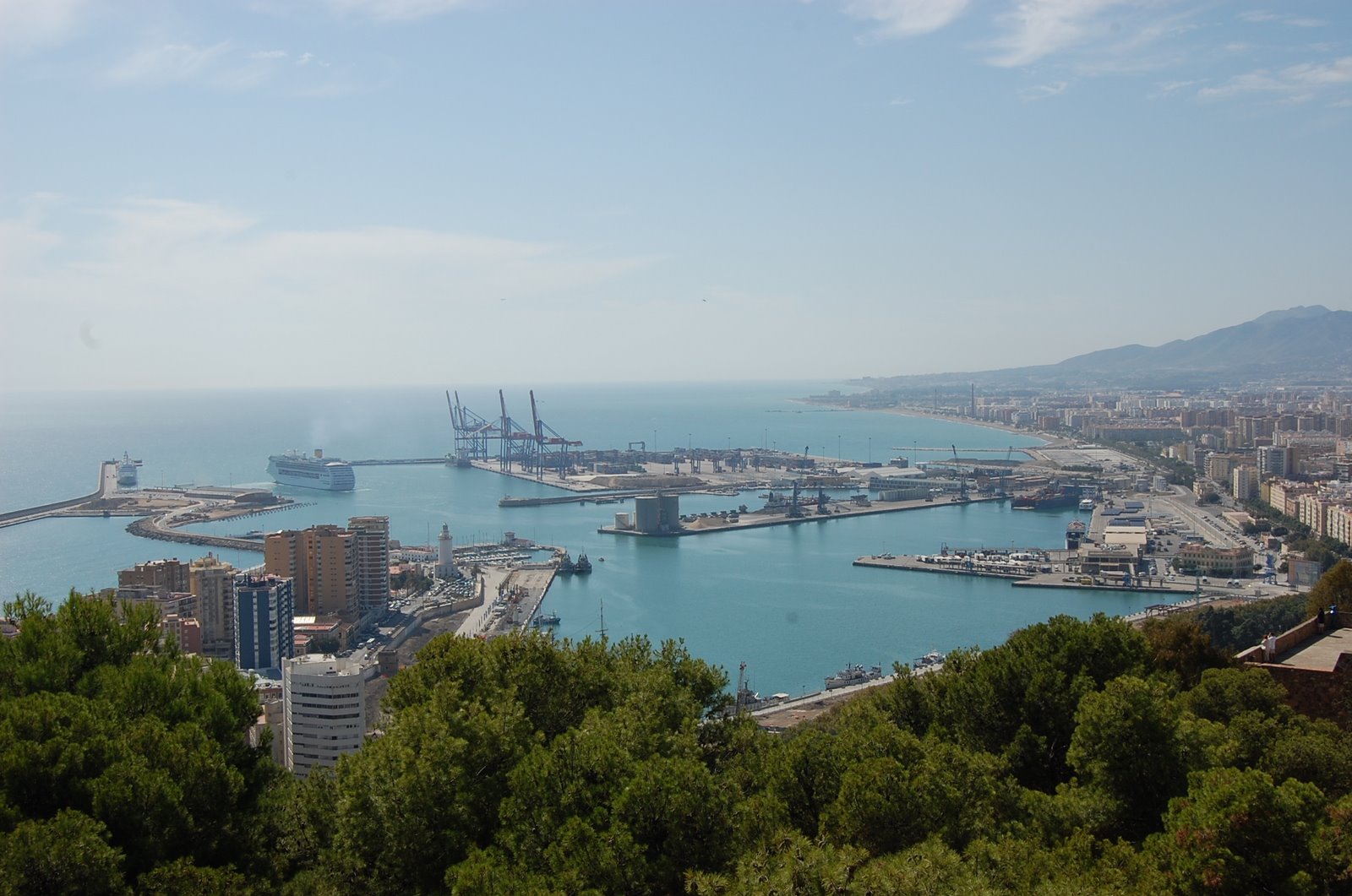
Málaga, as seen here from high atop its Moorish defenses, is Spain's second busiest port. Just as important is its airport which shuffles in nearly 10 million visitors annually into Europe's Florida (called "Costa del Sol.") Habitation started here no later than the Bronze Age and its written history goes back nearly 3 millennia starting with the Phoenicians. Carthaginians, Romans, Visigoths, Moors, and Christians and maybe even the Greeks have all taken a crack at running this place where the Guadalmedina river empties into the Mediterranean. 

A river runs through it (and sometimes over it)

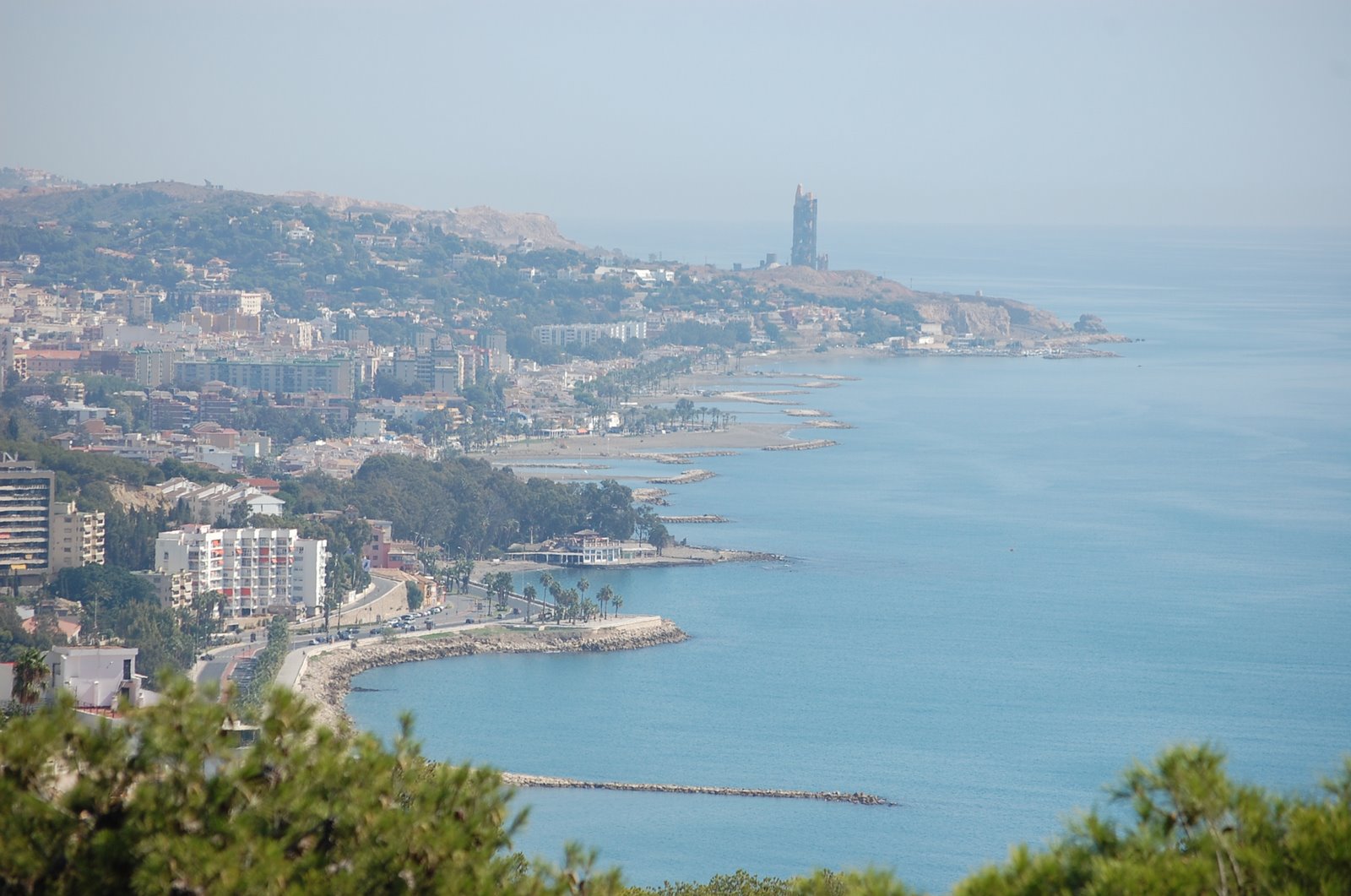
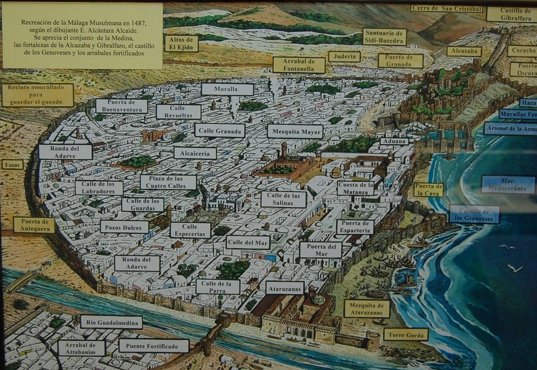
The river Guadalmedina drains into the Mediterranean and splits Málaga in two with its channel now cast in concrete. To Málaga 's west, descends another river, the Guadalhorce. 

map

The estuaries of these two rivers flow into the Bay of Málaga and form an alluvial coastal plain in the mountain amphitheater where the Phoenicians established a trading post in 1200 BCE. They found the place to be so fertile that they colonized and cultivated here as well as traded. But these rivers do not like men messing with their vegetation and frequently responded by flooding these interlopers out. (Thanks to the Wikipedia for use of this map.)

Málalga, Spain

Rio Guadalmedina wasn't always so docile. It drowned Málaga frequently until flood-control engineers tamed it in the 1930s. It's only 29 miles long and winds through the Sierra de Camarolos, a feisty mountain chain that insulates the coast from the much longer Guadalquivir valley that defines much of Andalusia.

Part of the flood control effort was to re-introduce vegetation on the slopes that the Christians had stripped to make the land yield crops. The unexpected consequences of their tillage was a lot of erosion that created flood plains in Malagueños' back yards. The resulting greenbelt became a protected area (now a park appropriately named "Parque Natural Montes de Málaga.")

These Sierras look quite arid with interesting formations from the Jurassic era when African and European plates smashed into each other to create vertical rises such as this.

Harbor views

Málalga, Spain

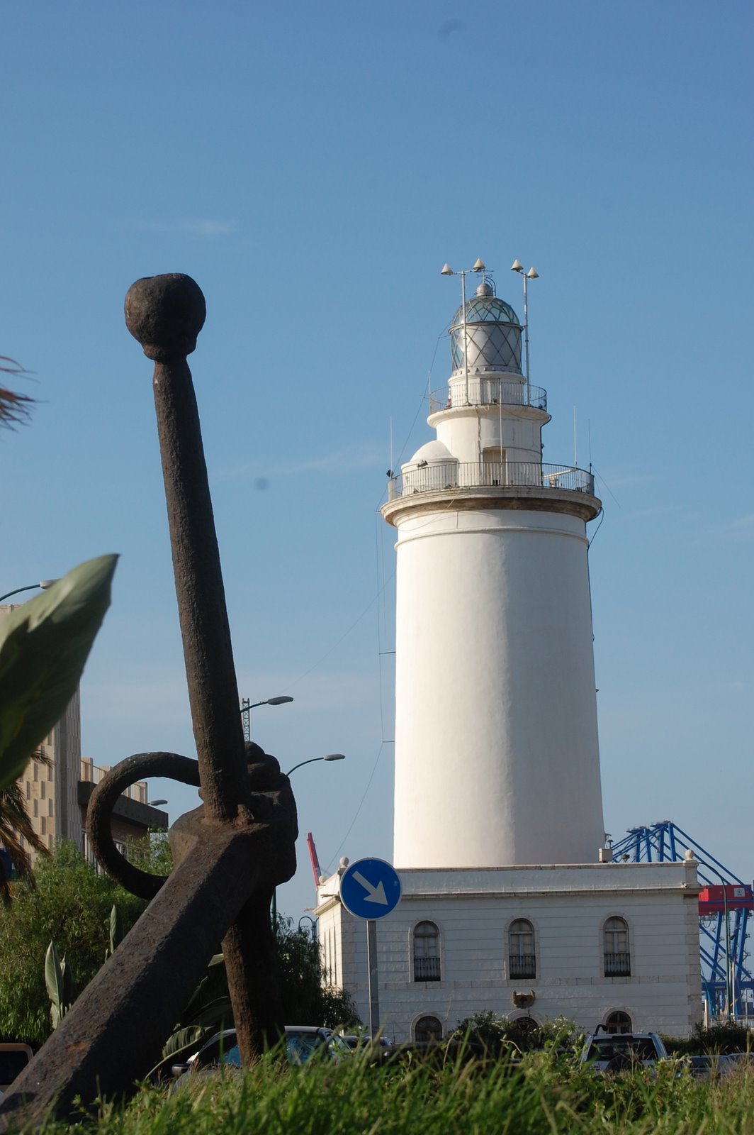
We look here east from the highest part of the city (558 feet) called Gibralfaro (Arabic for "Mountain of lighthouse" since those ancient Phoenicians had placed a lighthouse here.) 

The medieval Christian kings were not the first to make the mistake of stripping native plants in order to promote crop cultivation -- and inadvertently causing flooding through the subsequent soil erosion. The Phoenicians apparently had to abandon their first city at the mouth of the Guadalhorce in 580 BCE for the same reason. In the 20th century when the flood control engineers took back the slopes, they ripped out vineyards famous for sweet Málaga wines - but rendered all but useless by the phylloxera plague then destroying most 
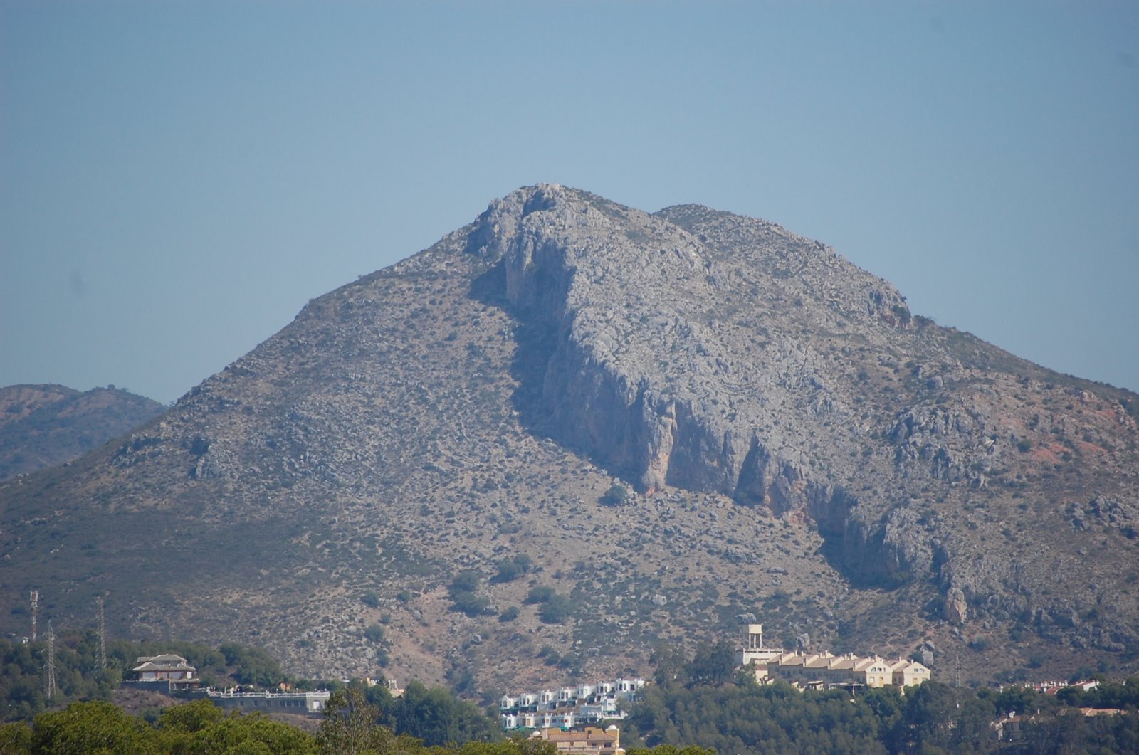
of Europe's vines. From this point on a clear day, one can see both African Mountains to the southeast and Gibraltar's famous rock to the west.


Málalga, Spain

The current lighthouse is now at a shoreline that probably did not exist in the Phoenician's day. Its beacon illuminates Málaga's harbor, second only to that of Barcelona in shipping tonnage in Spain.

Málalga, Spain

On this not-that-clear day, we look west over the port and the gray-sand beaches so popular with Europeans called the Costa del Sol which stretches on both sides of Málaga for a total of 100 miles. At far right is the Sierra de Mijas which separates modern Málaga from its western suburbs. Limestone and marble are quarried there. About a third of the time, vehicle traffic from this metropolitan area of about 800,000 gives Málaga high pollution days with enough suspended particles to keep tourists from seeing forever. Costa del Soot?

A wall ran around it

Málalga, Spain

This painting shows Moorish Málaga at the time when the besieging Christians starved the city into submission in 1487 CE. It suggests the amphitheater bowl where the Arabs built their town just east of the Rio Guadalmedina at bottom. (Guadalmedina means "river city" in Arabic.)

The city walls themselves formed the first of 3 encircling walls, with commerce controlled through 5 gates. All of that outer fortification is long gone but the double walls around the fort (about 2 o'clock in this picture) remain -- or at least have been restored. About 3:30 position, poking into the Mediterranean, are the forts built by the Genovese.

The ocean, here lapping at the foot of the fort, has withdrawn considerably in the succeeding 5 centuries, creating a wide path for parks, public buildings, and a bullfight arena.

Next we visit the old Roman Theater at the base of the hill that looms above Málaga.  Join us by clicking here.


If you have good bandwidth, Please join us in the following slide show to give the Málaga, Spain the viewing it deserves by clicking here.

Málaga, Spain


     Next: Roman Theater


Geek and Legal Stuff

Please allow JavaScript to enable word definitions.

This page has been tested in Google Chrome (preferred), Internet Explorer 8.0 and Firefox 3.0.

Created on 29 August 2009

Click to see more about the author

TIP: DoubleClick on any word to see its definition. Warning: you may need to enable javascript or allow blocked content (for this page only).
TIP: Click on any picture to see it full size. PC users, push F11 to see it even larger.
TIP: See the rest of our travel pictures by clicking here.